Science Programme
The expedition will capture a unique data set from both the physical properties of the Sentinels together with the biological data from the interface between the very bottom of the sea ice and the sea water, “a black hole” for biological data as Dr Karley Campbell puts it.


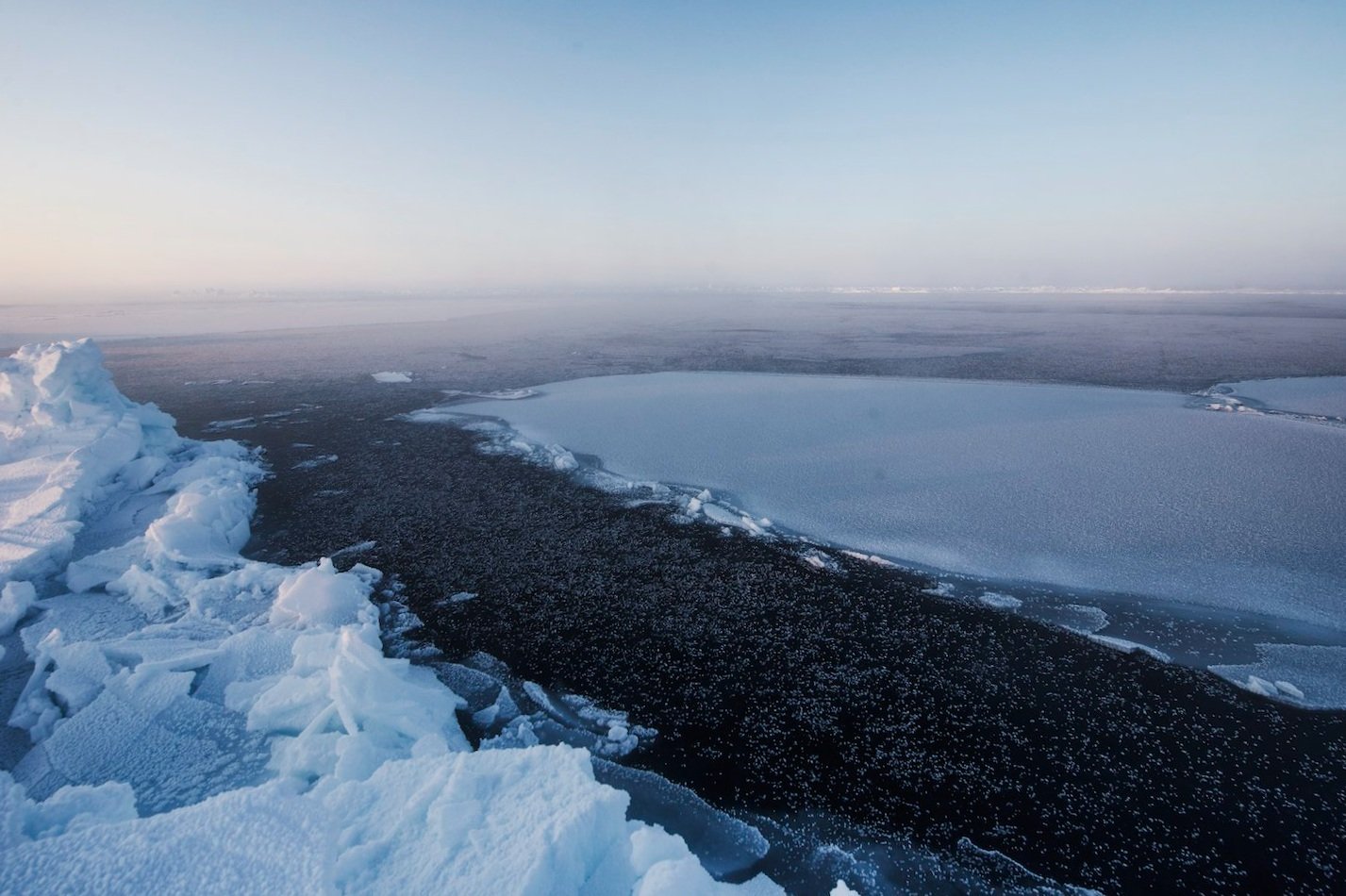
Capturing a unique profile of old ice sentinels in the Lincoln Sea.
The European Space Agency’s Cryosat-2 and Sentinel-3 satellites are essential for tracking future loss of Arctic sea ice, but their measurements of ice thickness require ground-truthing in the field to be truly useful in areas of rough (multi-year) ice. Last Ice Sentinels will traverse as much of the oldest multi-year sea ice in the Lincoln Sea as possible, taking ground measurements to verify the data from these satellites. This will generate an unprecedented, high-value dataset of ice thickness which vastly improves the current state of knowledge of Arctic Sea Ice change.
Sampling a changing sea ice ecosystem.
The sea ice cover of the Arctic Ocean is in fast transition from a state of thick multi-year ice to thin, seasonal cover. This will dramatically impact Arctic food webs upon which humans and other mammals depend. Algae that colonise the bottom of old multi-year sea ice are the base of the Arctic Ocean’s food chain. With access to the Lincoln Sea ice cover so difficult, our expedition will be able to gather a unique view of the sea ice ecosystem and discover if diminishing multi-year sea ice has impacted the food chain – affecting the lives of all Arctic Ocean organisms. Only a limited number of measurements exist across the Arctic to investigate biophysical controls of sea ice microbial life, particularly in remote locations like the Lincoln Sea. Data collected in this program will provide a critical dataset towards this understanding. Furthermore, it will permit the comparison of microbial communities and nutrient concentrations between the potentially contrasting conditions of Greenland and Canadian coastlines.


Checking if the old ice sentinels are melting from below.
Drilling through the sea ice to observe its ecosystem will give us access to the ocean below. We will use this exceptional opportunity to profile different water masses meeting in the Lincoln Sea and check how much ocean heat is upwelling to the base of the sea ice cover, providing a new source of ice melting.
Sampling and Modelling Opportunities.
We aim to maximise data collection at each of the sentinels visited en-route. This includes: oceanographic surveys with biogeochemical sampling of the sea ice and surface waters; installation of autonomous buoys to sample sea ice thickness, temperature and light transmission to the ocean; measurements of snow depth, sea ice thickness and surface roughness; and aerial imagery to build 3D scale replica models of the sentinels through photogrammetry.